Manufacturers / Sensors & Software Inc.
Ground Penetrating Radar (GPR) Instrumentation and Software
Sensors & Software Inc. is recognized worldwide as an innovative designer and manufacturer of ground penetrating radar (GPR) instrumentation and software. They develop GPR systems and software for numerous applications, including utility locating, concrete scanning, structural assessment, mining and quarrying, forensics, archaeology, geology, geotechnical and environmental assessment, glaciology, agriculture, and UXO detection.
Simplicity of use, reliability and industry leading data quality are cornerstones of their business. GPR solutions come in a variety of practical configurations and have intuitive user interfaces to ensure optimal data collection and performance. The combination of their diverse expertise, years of experience, world-leading products, comprehensive training resources and responsive service enables delivery of practical and effective solutions that empower their customers to make informed decisions.
Sensors & Software is recognized worldwide as an innovative manufacturer of ground penetrating radar (GPR) instrumentation and software. Their solutions allow their customers to meet the demands of todays rapidly evolving environments including Utility locating, Construction, Forensic & Law Enforcement, Mining & Quarrying, Geotechnical, Archaeological, Agriculture & Forestry, Ice & Snow and Military.
Sensors & Software joined Radiodetection in November 2020 and now is a part of SPX Technologies, expanding Radiodetection’s ground penetrating radar (GPR) offering. With offices and a network of dealers worldwide, they are well-positioned to serve our existing customers and cultivate new markets.

The company has developed GPR systems for numerous applications, including structural assessment, mining and quarrying, utility locating, forensics, archaeology, geology, environmental assessment, glaciology, agriculture, and UXO detection. Their GPR products come in a variety of practical configurations and have intuitive user interfaces to ensure optimal data collection and performance.

Sensors & Software manufacturers a number application-focused GPR systems, including CONQUEST® 100 for concrete scanning, LMX® for utility-locating. All systems are easy-to-use with rugged, weatherproof assemblies and are built on low-power, compact, and trail-blazing digital electronics. The subsurface images from the GPR systems appear in real-time and can be recorded digitally for review or post-processing.
LMX® GPR Overview
Ground penetrating radar to detect both shallow and deep targets simultaneously
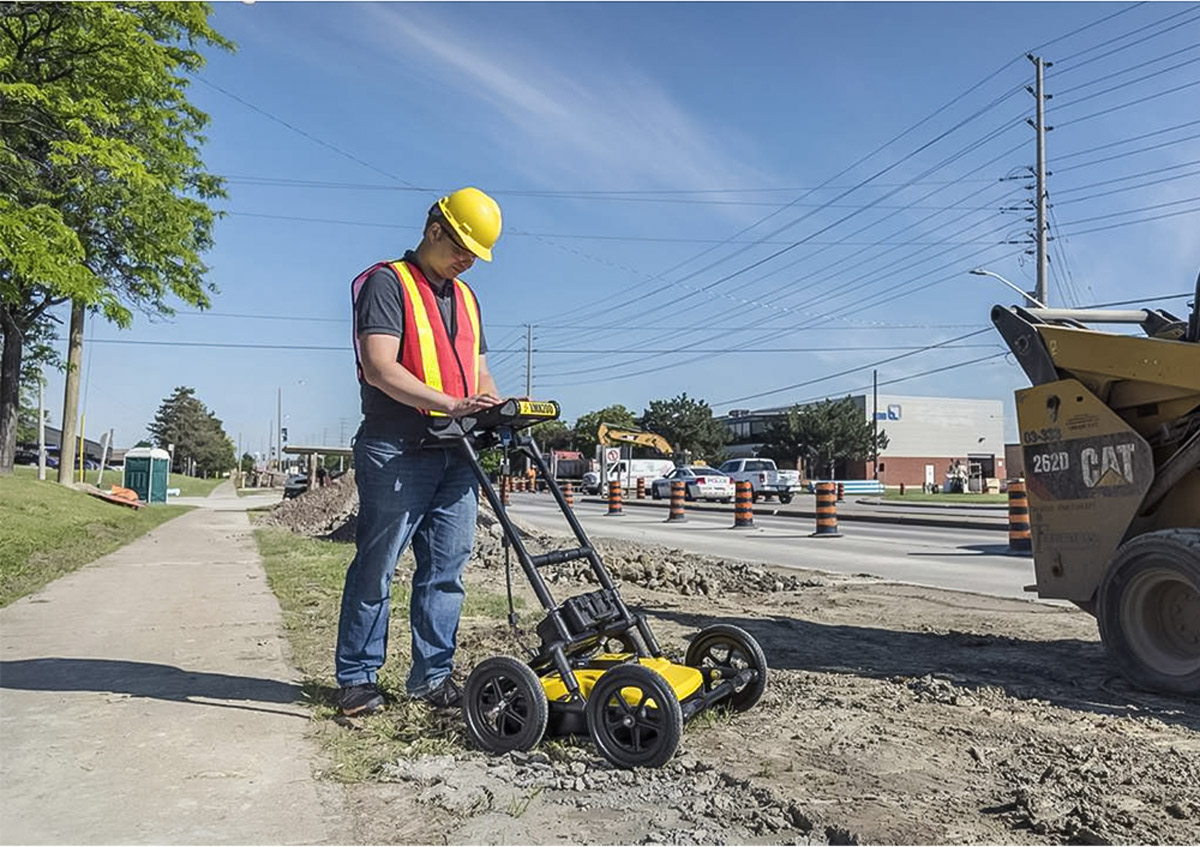
LMX® Ground Penetrating Radar (GPR) systems are designed and optimized for utility locating, making it easy to add GPR to your locating workflow. LMX GPR systems detect both shallow and deep targets simultaneously and quickly display the results on the display unit in the field.
GPR is widely used for utility location and is used for identifying and marking utility mains that are underground. GPR offers a safe method to locate underground utilities that include natural gas lines, oil and gas pipelines, cable television, fiber optics, national telecommunication lines, electricity distribution, traffic lights, street lights and so on.
GPR is also used for locating storm drains, water mains, septic systems, sewer laterals and wastewater PVC pipes.

The LMX® system is a great complement to traditional pipe and cable locators and allows you to Locate & Mark®:
- Metal utilities, including pipes and cables
- Non-metallic pipes, including PVC and asbestos cement
- Concrete storm and sewer systems
- Utilities where installed tracer wiring has failed
- Underground storage tanks and drainage tiles
- Septic system components
- Non-utility structures such as vaults, foundation walls and concrete pads

Software is a major part of all of Sensors & Software Inc.’s activities and we develop all our GPR data analysis software in-house. Our state of the art EKKO_Project™ software makes complex GPR analysis easy with intuitive tools to organize, edit, process and plot your GPR data. Powerful visualization, assessment and integration tools allow you to quickly and easily produce impressive reports.

GPR offers a safe method to locate underground utilities that include natural gas lines, oil and gas pipelines, cable television, fiber optics, national telecommunication lines, electricity distribution, traffic lights, street lights and all associated buried infrastructure in all forms.
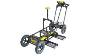
LMX® Products

LMX100™
GPR Locate & Mark® Underground Utility
The most affordable GPR utility locating tool to Locate & Mark utilities in the field with its intuitive user interface, rugged and lightweight design.
![]()
LMX150™ FINDAR® Ground Penetrating Radar
A complete Ground Penetrating Radar system, offering two modes for acquiring data: Line Scan and Grid Scan. Once the unit is assembled and powered-up, you can start conducting a GPR survey in less than a minute.

LMX200™
GPR Utility Locating Equipment
The premier GPR tool for locating professionals, the premier GPR tool for locating professionals, featuring all the capabilities of the LMX100™ plus additional in-field capabilities.
Concrete Scanning
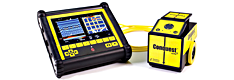
Conquest® 100
Concrete Scanner
Gain accurate insights of objects below the concrete surface, even on a curved surface or column.
NOGGIN® GPR Systems
NOGGIN® GPR Systems
NOGGIN® GPR systems have been recognized by leading researchers as providing the highest quality GPR data in the world. They are also built to perform in the most demanding conditions around the globe.
TELONIX stands behind every product sold, with unmatched technical support.